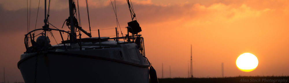

View from Mustang, down the valley we would take towards Ghasa and ultimately Beni
04/01/13
We got up early and after a quick breakfast went onto Jomsom’s main street to catch the 8am bus, only to find it had left early. We waited 45 minutes for another one. We hopped in and paid an extortionate price to go all the way to Beni, over double what we’d paid to get up here! Despite our protests the ticket man wouldn’t budge and Sophie made him dig out past tickets to show us. It’s a set tourist price, what a joke! Anyway, as we’d been in the dark on the way up it was good to see the views, passing many barren orchards and stopping in the next little town for a while. It had a huge Tibetan temple in it, looking almost like a castle with multiple layers – it looked like photos I’d seen from Tibet.

The mighty temple at Mustang
The bus bumped its way all down the mountain over the next 8 hours. It was horrendously dusty, so bad we had to cover our faces to breath. My Kindle acquired a thick layer of dust. The ride was extremely uncomfortable, with only one short stop for lunch in the bus park in Ghasa. We were sore and thankful when we got off in Beni (where we’d started our trip) at 4pm. Immediately I started asking around for buses to Pokhara just in case we could still get one. We got lucky, there was one just leaving and we somehow got a seat despite most of the bus standing. This was another long 5 hour ride, and we were delayed waiting for some big rock trucks to unload their cargo on the way. It was dark as we crossed over the hills and in Pokhara we caught a taxi to Noble Inn in Lakeside. We were exhausted after the most uncomfortable day travelling so far, grabbed some dinner and got an early night, glad of a real hotel after the basic comforts of the mountains!

A very Tibetan looking girl watched us from the roof of this house in Mustang
05/01/13 – 12/01/13
We had a day free to chill out before Sophie needed to go to Kathmandu, so we spent it relaxing by the lakeside. The next day we caught a tourist bus to Kathmandu, which took all day, checking into a hotel in Thamel. The following day Sophie’s mum Ellen arrived, they were going to do some travelling together. We went out for dinner once she’d arrived. On the way back we encountered the ladyboy prostitutes of Nepal (I had no idea there were any!), who took great delight in trying to chat us up! Sophie’s mum didn’t even realize they were boys! Apparently there was a scandal not too long ago when a prominent politician had been caught picking up ladyboys in this hot-spot.
The next few days I spent chilling out in the city whilst Sophie took her mum out to the sights. I’d already booked a flight back to Thailand so I just relaxed, caught up on the blog and met the others for meals. We enjoyed some live Nepali music in a courtyard restaurant and we discovered a good pizza place called Fire and Ice, and a really nice western-style café with sofas and great coffee which we hung out in a lot. At night it was incredibly cold, thick blankets were needed. In fact the news said it was a new low for Kathmandu in over 50 years.

Road from Mustang to Beni, pictured is one of the jeep taxis which ferry locals around the area
On the last day I said my goodbyes to Sophie and her mum. They were going to go up to Karmidanda, the village up in Langtang, to stay with Jabraj, and then see more of Nepal before going to India for a month. I caught an early plane from Kathmandu airport, unfortunately not getting a chance to get rid of my Nepali money – for some reason they don’t have exchange counters once you’re through customs! And I couldn’t change it in Thailand either, grrr! Consider yourself warned!
The flight to India had some incredible views of the Himalyas (I’m sure you could see Everest too), but I was gutted because I was on the wrong side of the plane and could hardly see it. On my side were endless jungle hill ranges with seas of mist hovering below them, good, but not as great as the jagged peaks I could glimpse on the other side.

A shale field up near Jomsom
After a change-over in New Delhi, I arrived in Bangkok, Thailand at 5pm. I decided to make use of the local transport and walked to the BTS station, the “sky train” which travels on a suspended railway above the roads. It was very easy to use with computer terminals and announcements in English. In half an hour I was in the centre of Bangkok and caught a taxi through horrendous Saturday night traffic to Khao San Road. I stayed in Sawasdee, a hotel I’d frequented last time, and went out for food and drinks. It was strange to be back in Thailand, it’s so different to Nepal and even Khao San Road seemed chilled out compared to the madness of Kathmandu’s streets. This was my fourth time back in Thailand!

Looking out over a Nepali town as as I fly towards India


